Widgeon Peak
- Kaitlin
- Jul 5, 2024
- 3 min read
Updated: Oct 20, 2024
July 5, 2024
Distance: 28.2km round-trip
Elevation gain: 1760m
Time required: 14-15 hours total
Bagging Widgeon Peak was a big one!
There are 3 trailheads to this peak:
Via Widgeon Bowl Trail in Pitt Meadows. This is the shortest route with the major caveat that the trailhead cannot be accessed by car or foot. You must paddle through Widgeon Slough from Pitt Lake in order to reach the trailhead. The journey to the trailhead itself is beautiful and there are other hikes accessible from the landing area.
Via Munro/Dennett Lake trail in Pinecone Burke Provincial Park. This is the shortest but steepest of the two trails accessible by foot. It cuts off a significant amount of the distance required to reach the Burke ridgeline.
Via Harper Road in Pinecone Burke Provincial Park. This is the longest route with more gradual elevation gain and the one that I did.
As mentioned above, the route that I chose to reach Widgeon Peak was via Harper Road. This is a popular access point to the numerous mountain biking and waterfall trails found within Pinecone Burke.
The trail climbs the old Harper access road for several kilometers before reaching the Burke Ridge Trail. The trail is relatively well-marked and easy to follow at first, consistently becoming less maintained and more overgrown the further you go. At this point in the season, it is also quite muddy. Snow patches started at 1200m elevation, which surprised me as the current snowline elsewhere was around 1400-1500m. I was constantly taking my spikes on and off as I ascended or descended,
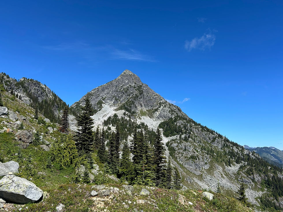
Once reaching the ridgeline, there are several established viewpoints along the way to Mount Burke's north summit, which I have covered in more detail in my blog post about this hike. This includes several rock bluffs and Mount Burke's south summit. Once reaching the north summit, there is another ridgeline trail leading eastwards which explores the north summit ridge. This is where I ended my hike when I first explored Mount Burke. The elevation gain up until this point is quite gradual as it is gained over many kilometers of trail.
This time, I continued northward on the Burke Ridge trail, first reaching the north side of the north summit of Mount Burke (confusing, I know). It is at about this point that the trail becomes increasingly difficult to find. It is sparsely flagged and turns into a faint game trail.
The trail descends down into the Burke-Widgeon pass, which is where the junction for the Widgeon Bowl trail is located (the trail accessible by paddle only). Interestingly, once past the pass, there was not much snow on the trail despite being at the same or higher elevation than the previous areas.


Hiking from the saddle to Widgeon Peak is for experienced hikers only. It involves serious bushwhacking, route-finding, and scrambling. There were a few pieces of flagging tape to be seen but not much. As a result, I took it upon myself to flag the route. It is now well-marked, though still difficult in terrain.
After an almost 9 hour effort (including a quick 15-minute lunch stop), I finally reached Widgeon Peak. There were stunning 360 degree views.


The journey back took a further 5 hours. At one point while still on the ridgeline, I saw something come crashing out of the bushes and run down the mountain. It went far too fast for me to see what it was but it was big (a bear?) and the sudden commotion scared me. I booked it out of there.
I reached the trailhead about half an hour after sunset, just as it was starting to get truly dark. I had ran the last 5 km in an effort to not return in the dark and almost succeeded. I felt surprisingly good after such a long day. To date, it was my longest day hike both in terms of distance and time at almost 15 hours long.
There are many water sources on this trail in the form of streams and run off from snow melt. For such a long hike and on such as hot day, it was necessary to have access to water. As mentioned earlier, this is a very difficult trail on many levels. I wouldn't recommend this to anyone but experienced hikers. For dedicated peak baggers like myself, it is a worthy endeavor.


Comments