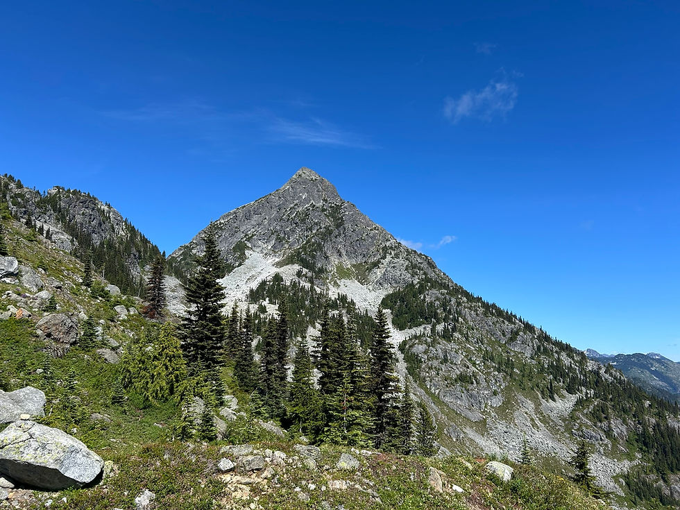
Mount Nutt (North Peak)
- Kaitlin
- May 10, 2024
- 4 min read
Updated: Oct 20, 2024
May 10, 2024
Distance: 13.4km round-trip
Elevation gain: 1397m
Time required: 9-10 hours total
Summiting the north peak of Mount Nutt in Golden Ears Provincial Park has been on my radar for a couple of years now. There's no official trail. It's a choose-your-own adventure route. And an adventure it was.
The marked trail officially ends at the false summit of the south peak of Mount Nutt. This is the viewpoint that 99% of people stop at. There is an official 'end of marked route' sign there. However, there is much to be explored beyond this viewpoint.
To get to the north peak of Mount Nutt, you must first descend down a steep forested slope, following sparse flagging tape. There is a marked trail on AllTrails that you can use to guide your way for some additional guidance. It is pure bushwhacking, the route almost entirely covered by huckleberry and blueberry undergrowth. Once you descend to the bottom of the col, you then ascend to a ridgeline which is the south summit of Mount Nutt. I have a separate blog post about hiking the south peak of Mount Nutt a year prior. At this time of year, the snowline started at 1100m. Which meant only the last 100m of elevation contained any snow. I was wearing microspikes and they worked just fine.

Getting to the north peak from the south peak is where the real adventure begins. The process to get to the north peak is the same as the south peak except even steeper and there is no official trail nor any markings of any kind. However, I started to flag a route to the north peak with flagging tape. However, I only got about halfway down the northern slope of the south peak before running out of flagging tape. In hindsight, I should have brought multiple rolls of tape as you use way more than you think you will.
After the steep descent, you start ascending to the north peak, reaching a rock outcrop at about 1150m elevation. You can either go around it in either direction (left or right), or do what I did and climb it. It is not exposed and thus only requires some scrambling skills. It is also shrouded in the same bushy undergrowth that you have been bushwhacking through the entire time which you can use as handholds.
After coming out onto the ridgeline, it is only a short walk to the summit of Mount Nutt. It was a beautiful day and I could see clear views of the surrounding mountain ranges and Alouette Lake.
Unfortunately, I don't have any photos from the north peak. This is because I lost my phone as I was coming back. This marked my 5th time losing or dropping my phone while hiking and it appeared that my luck had finally run out. I noticed it was gone somewhere on the north side of the south peak, as I was ascending back up that slope to get to the south peak. It had fallen out of my hip pocket somewhere on the slope. I searched for about half an hour in the snow and bushes, but I knew immediately it was a lost cause. I went through the entire 5 stages of grief during that time spent looking for my phone. Initially, denial that it was lost. Then anger that I could have lost it without hearing or seeing it fall. Then bargaining, as I promised the universe many things in response to letting me find my phone. Slowly, that morphed into depression as the reality began to sink in and then finally grim acceptance, knowing I had to move on. Thankfully, the route was marked with my own flagging tape, which I gratefully followed all the way back to the official trail. I kept reminding myself how lucky I was that I hadn't lost it earlier, when I had no markers to follow. There were a lot of ways in which it could have been worse. I have always been paranoid about losing my phone and thus losing things that have importance and value to me. Because of that, I had a habit of backing things up regularly. Unfortunately, I hadn't backed up any photos since the beginning of the year, causing me to lose four months worth of memories and adventures. But four months is better than four years. It was also only the beginning of peak hiking season so I didn't have too many adventure photos accumulated yet. Again, there were so many ways in which it could have been worse.
However, unbeknownst to me, it was about to get worse. Somehow, I ended up losing my GPS too. I carried a Garmin eTrex 10 with me on all hikes as a back-up GPS in case something ever went wrong and I got lost. On this particular hike, I had shoved it in a small zippered pocket on the back of my backpack. I can recall it being with me the entire trip. The only point in which it is possible to have lost it was when I stopped a few kilometers from the trailhead to refill my water bladder and re-apply chapstick. However, I surely would have seen or heard such a clunky bright thing fall to the ground upon opening the pocket... So as of today, it remains a complete mystery as to how I lost that.
Losing two expensive devices in a single day was definitely a bummer. The phone more so than anything. However, these things happen and I simply have to use it as a lesson to be extra careful with all my gear and triple check I have everything with me at all times.
Personally, unless you're a weirdo like me and have this internal desire to explore everywhere humanly possible, I wouldn't consider the north peak of Mount Nutt to be that worthwhile of a hike. The effort to reward ratio isn't super high given the considerable bushwhacking combined with navigation skills needed. However, if you're up for an adventure, then by all means, go explore Mount Nutt! Let's just hope it won't be the kind of unfortunate adventure I had.


Comments