Howe Sound Crest Trail
- Kaitlin
- Sep 7, 2023
- 4 min read
Updated: Oct 29, 2024
September 7-8, 2024
Distance: 28-30km point to point
Elevation gain: 2514m
Time required: 2-3 days
I have been wanting to do this trail for a long time! While many people split this trail up into 3 days, I like to do long days of hiking so I knew 2 days would be ideal for me. I did it in a beautiful weather window - completely clear skies and warm temperatures.
Note that if you are hiking this route from south to north (the most popular), you must park in the overnight parking lot (3B) at Cypress Provincial Park otherwise your vehicle will be towed. You may also do this trail from north to south, starting at Porteau Cove. You do not need an overnight parking permit if you are planning to do this route. As this trail is point-to-point, you will need to arrange someone to pick you up at the trailhead.
Day 1
16km
9.5 hours of hiking
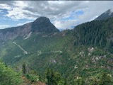
The first day I went from the trailhead at Cypress Provincial Park to Magnesia Meadows. This took me firstly to St. Mark's Summit, then on to Unnecessary Mountain (perhaps named because it is a rather unnecessary hump that you must traverse to get to better destinations), then on to The Lions. There is a scramble that takes you to the top of the West Lion, which I did. I had stupidly put my phone in my shorts pocket, as I did not want to take any gear with me on this climb. This was a risky and foolish move on my part and sure enough, as I was climbing back down, I suddenly noticed my phone was not in my pocket anymore. Thankfully, there was some divine intervention on my behalf and I found it just a couple of meters from where I was. This was the 4th time I had lost or dropped my phone while hiking, each time the rescue more miraculous then the last.
After the West Lion, I lost the trail and started traversing down a scree slope. After a bit, I realized I was not following the trail and went back up the slope to re-find the trail. After re-orienting myself, I continued through Enchantment Pass and then onto James Peak and David Peak. I then descended into Harvey Pass before finally making it to Magnesia Meadows where I set up camp beside the tarn that is just before the emergency shelter and commode.
Note that some of my pictures did not transfer properly and so the quality is unfortunately quite poor.


Very interestingly, I hadn't seen a single person all day. This was surprising to me, as the HSCT is very popular and the weather was great.
I had the entirety of Magnesia Meadows to myself that night. I love being completely alone in the backcountry. In the complete silence and immensity of your surroundings, you realize that you are part of something much greater and larger than yourself. It's a primal, ineffable kind of feeling. You feel connected to the entire universe. It's quite a spiritual experience.
That night, I could hear a bear roaming around the area in which I was camping. I was aware and alert but not exactly scared. My food was well hidden and away from me. Bears are a part our ecosystem. We live and play in their territory. I always think about how our ancestors lived in peace amongst the bears and I strive to do the same.
Day 2
14.5km
8 hours of hiking
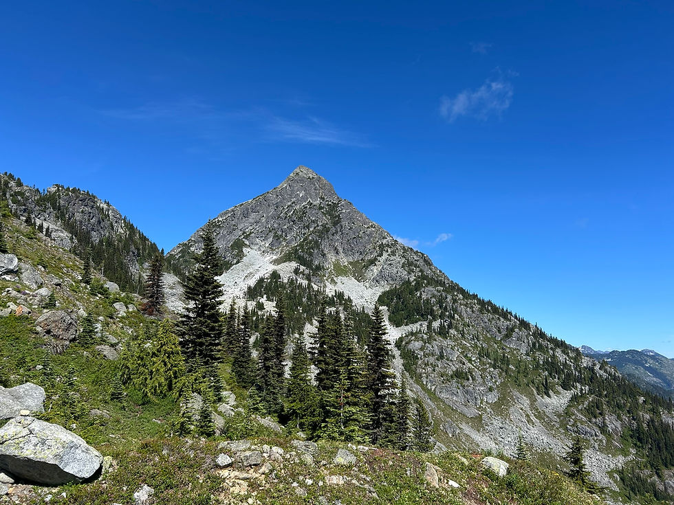
On this day, I went from Magnesia Meadows to the HSCT terminus at Porteau Cove. From the meadows, I followed mother and baby bear tracks all along the trail as I climbed around the base of Brunswick Mountain. When I came to the trail junction, I decided to make a side quest up to the summit. I hiked up there with my big pack and was met with stunning morning views. After spending a bit of time at the top, I came back down and continued on my way.
At Hat Pass, there are two scree slopes that have near perpetual snow banks across them that typically persist into August. However, at this time of year in early September, they had fully melted, making traversing across the slopes a breeze. Eventually, I descended into Brunswick Lake. I then passed Hanover Lake and Deeks Lake.
It was somewhere before reaching Deeks Lake that I realized my sleeping bag was no longer attached to my pack. I considered turning back to go and find it but did not want to add what would likely be several more hours to my journey. I therefore accepted that it was gone and was now someone else's to enjoy. After Deeks Lake, I headed into the forest to do the final stretch of trail to the Porteau Cove trailhead and parking lot. I had arranged for my boyfriend to pick me up and thankfully, I arrived approximately when I estimated that I would.


Overall, this was one of the best trips that I've ever done. The views were beyond stunning and being in the alpine is my favourite thing in the whole world. I plan to re-do the trail next year and do a slightly different route in order to reach peaks that I didn't do this time.


Comments